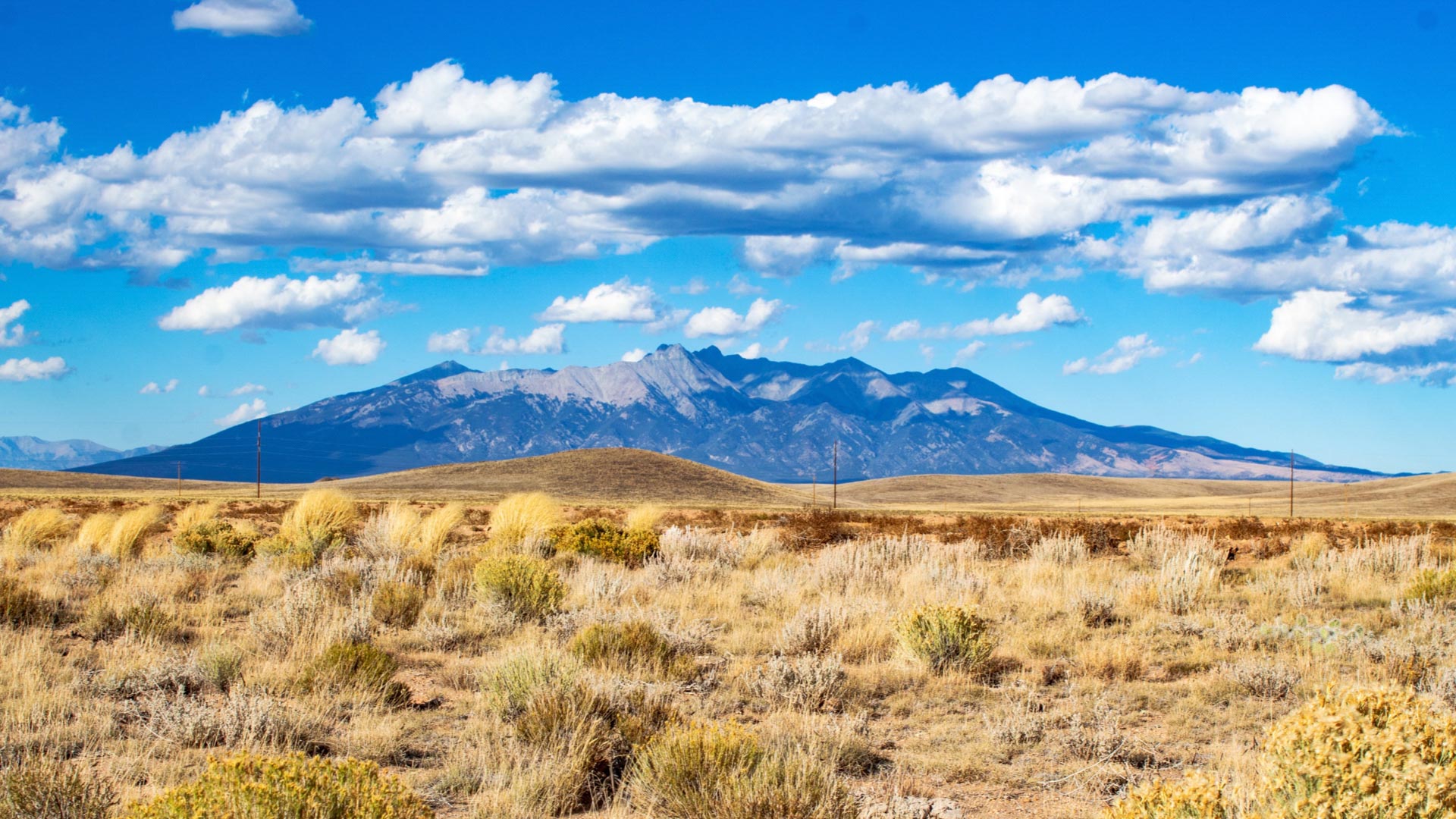
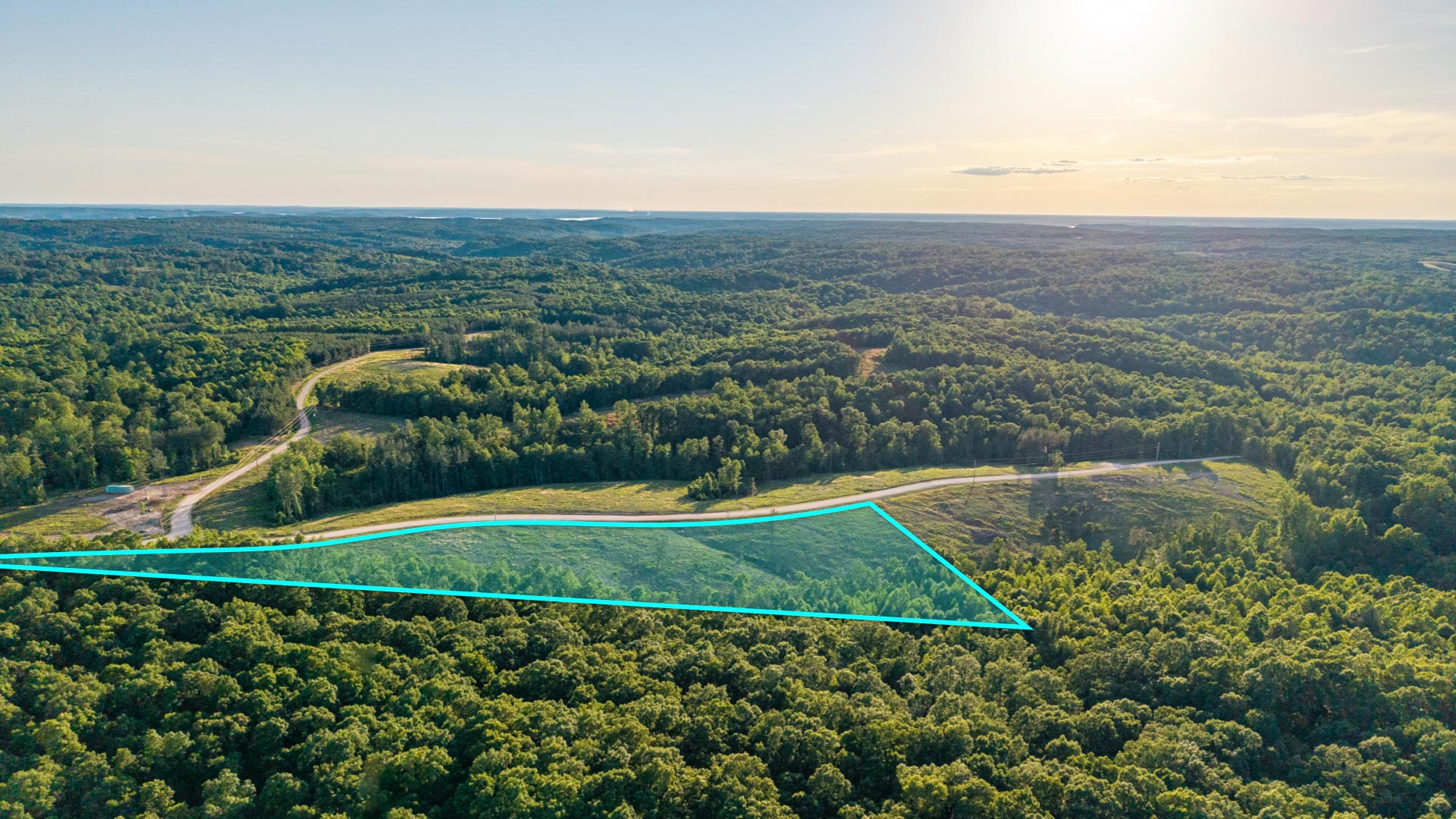
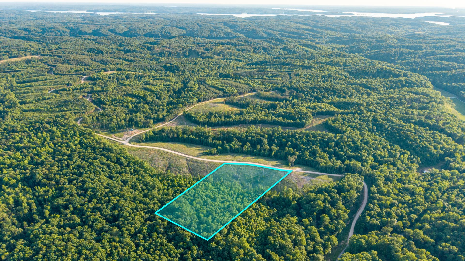
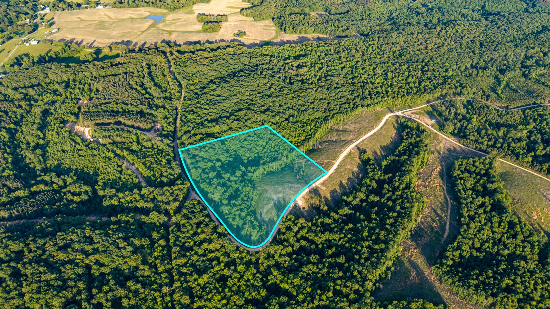
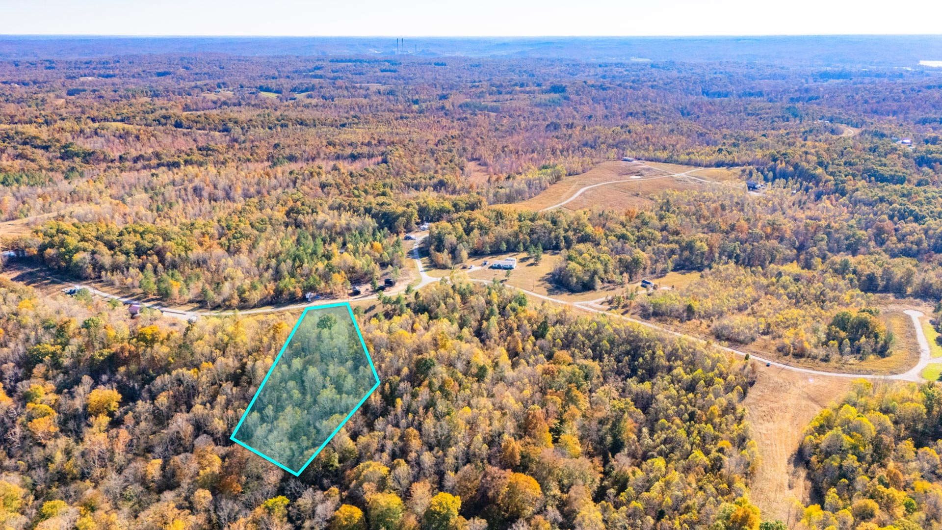
2.31 Acres Forested Lot with Power in Developing Area
Loading
Loading


LANDIO ID
OR_Klamath_00002
Oregon
Klamath
2.31
Acre +/-
Acres +/-
Sold
Pending sale
$
$
15000
15000
USD
USD
Price
To Be Determined
Price
To Be Determined
The Sale of this Property is Currently PENDING.
Explore the AVAILABLE Properties
Price
To Be Determined
This Property is Presented by The Hemingway Land Company
For Questions or to Purchase this Property, please visit Hemingway Land
You may also contact Hemingway Land Customer Support anytime by Call or Text at: 702-919-7170
You may also reach Hemingway Land by email at: Support@HemingwayLand.com
Reference LANDIO Property ID: OR_Klamath_00002
Would You Like to See Your Property Featured on LANDIO? Visit: LANDIO.com/Feature
To Speak with LANDIO, Call or Text Us Anytime at 866-8-LANDIO (866-852-6346)
Property to Sell? Visit: SELLwithLANDIO.com
Property Specs
Property Description
Property Description
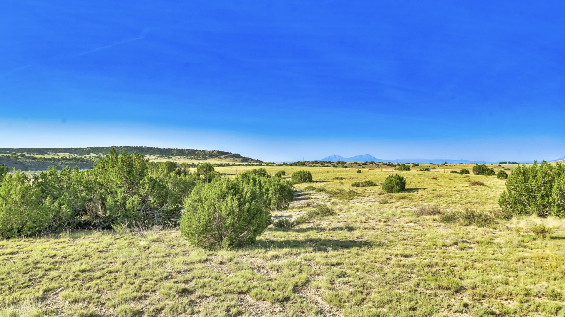
The subject property is a 2.3 acre lot located in Klamath Falls Forest Estates, a sprawling rural residential community situated just off Highway 140 and roughly twenty miles east of Klamath Falls.
While this subdivision is quite large occupying roughly forty miles of land, the subject property is located in Unit 2, the southwestern most part of the subdivision and the region which sits closest to Klamath Falls.
Legal Information
Legal Description: Klamath Falls Forest Estate, Unit 2, Block 59, Lot 18
Parcel Number: 3811016D004000
Account Number: R471536
Annual Taxes: $88.00
Access & Utilities
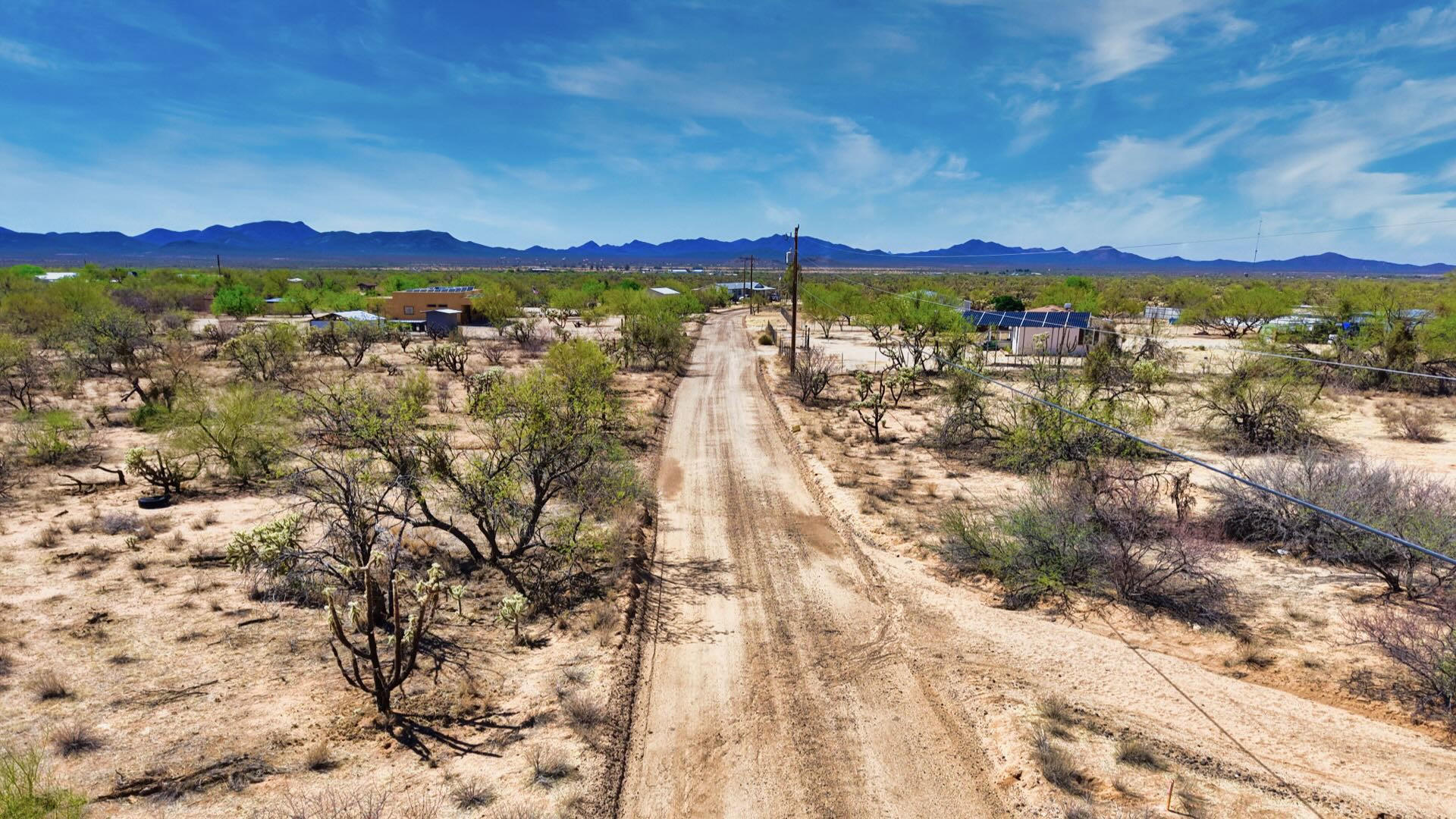
Roads & Access: The subject property is located along Brant Drive, a well-maintained two-track gravel road which can be navigated by any vehicle type. In addition, the subject property sits in close proximity to Highway 140, meaning there are only a few unpaved roads one will need to traverse when visiting the land.
Power & Utilities: Unlike other parts of this sprawling subdivision, utilities have a greater presence in this specific region. This includes at the subject property along Brant Drive as well as along most of the neighboring roads. In addition, underground utilities can be found servicing developed home sites as close as the nearest intersection of Brant and Possum, roughly five hundred feet away. Because of this, it should be easier and more affordable to develop the land. Anyone looking to investigate the costs associated with getting service connected on the subject property is encouraged to contact Pacific Power, the utility company servicing this region.
Wells & Water: The average depth of wells drilled in this specific part of the subdivision ranges from 213-270 feet with an average GPM (gallons per minute) ranging between 8 and 40. For a more accurate sense of the costs involved in installing a well here it is best to contact well drillers local to the region.
Zoning & Restrictions
Zoning: The Klamath Falls Forest Estates subdivision is zoned R-2 Rural Residential, a designation whose purpose is to establish and maintain areas for rural residential uses. This may include everything from single family residences to small-scale hobby farming. To learn more about the R-2 Zoning Designation, please see the attached PDF.
No HOA: The Klamath Falls Forest Estates subdivision has no HOA and there are no annual dues associated with land ownership here.
Covenants, Conditions & Restrictions: According to the County, there are no covenants, conditions and restrictions (CCRs) on file for this Unit of the Klamath Falls Forest Estates subdivision. This means that anyone looking to use or develop the land will only need to familiarize themselves with rules imposed through the County zoning code.
Acceptable Structures: It should be noted that per County zoning, acceptable structures for this region include single family residences, mobile homes and manufactured homes. Additionally, the minimum square footage requirement here is only 300 square feet, meaning this area is ideal for tiny homes as well. To learn more about developing the land for residential purposes please contact the Klamath County Planning Department.
Camping & RV Use: The subject property may be used for camping but only for twenty-one days in a six-month period. Anyone looking to stay longer than seven consecutive days must acquire a permit from the County. Additionally, RVs may be used here but only for recreational purposes. RVs may not be used as permanent residences though may be used for longer if the owner has acquired a building permit (meaning if they’re in the process of building the permanent home site). Tiny homes with a trailer frame, meaning those not on a permanent foundation, are classified as RVs and thus must be registered with the state DMV. Any use of such a vehicle on the land would be considered recreational and not residential. To learn more about using the land recreationally please contact the Klamath County Planning Department.
Title Info
Title: Free & Clear
Liens And Encumbrances: None
Mineral Rights: None
Recent Survey: None
Title Insurance: Yes - Insured Through AmeriTitle
Conveyance Document: Warranty Deed
Suggested Type Of Closing: Title/Escrow
Doc Prep Fee: Waived
Miscellaneous
Fire Department: It should be noted that the local Klamath Fire Department sits along Highway 140 less than two miles from the subject property at the entrance to this part of the subdivision. The presence of such fire suppression services can prove invaluable to anyone developing land in a forested region such as this.
Nearby Towns
While the town of Beatty is close to the subject property it is ultimately very small and offers little more than a post office. Anyone looking for food and supplies will need to venture into nearby Klamath Falls, the County seat which sits in close proximity to this subdivision. Home to 22,000 residents, this vibrant community boasts hospitals, schools, parks and churches as well as places to shop, dine and relax, including the picturesque Klamath Lake.
Beatty: 17 miles (25 min)
Klamath Falls: 29 miles (44 min)
Chiloquin: 45 miles (55 min)
Lakeview: 72 miles (1 h 22 min)
Nearby Attractions
Discover Klamath (Click Here)
Fremont-Winema National Forest (Click Here)
Klamath Basin National Wildlife Refuge (Click Here)
Sprague River (Click Here)
Crater Lake National Park (Click Here)
Sycan Marsh Preserve (Click Here)
Visiting The Property
Anyone who would like to visit the subject property is welcome to do so any time of any day they please. As Hemingway Land does not have offices local to all the properties that we buy and sell, however, a representative from our Company will not be able to join you on your scout.
The maps provided below have been included to help you in locating the property. Interested parties are encouraged to review them prior to visiting the land.
LANDIO Generated Interactive Map (View Map)
LANDIO Generated Download Map (KML File)
LANDIO Generated Download Google Earth
GPS Coordinates
Northwest Corner: 42.27250,-121.41730 (Google Map)
Northeast Corner: 42.27310,-121.41570 (Google Map)
Southeast Corner: 42.27270,-121.41540 (Google Map)
Southwest Corner: 42.27200,-121.41700 (Google Map)
Center Point: 42.27260,-121.41630 (Google Map)
Purchase Process
This property is presented by The Hemingway Land Company.
• To initiate purchase of the land you’ll be asked to place a non-refundable earnest money deposit of $500 through our website.
• You may elect to fund and close this transaction either by paying our company directly or by employing a title company. At checkout you’ll be asked to select your preference.
• Within 24 hours of your deposit, we will email you the documentation that corresponds to your selection.
•If you elect to close outside of escrow, that email will include a new deed plus payment instructions. Buyers may pay the remaining balance via credit card, wire transfer or cashier’s check.
• If you elect to close through a title company, that email will include a copy of a Sale/Purchase Agreement. You must review and sign this document within 96 Hours to open escrow. A copy of the Sale/Purchase Agreement you’ll be asked to sign can be viewed here.
• Please be advised, this is not an installment sale. This is a cash purchase. You should not initiate this transaction unless you are prepared to pay the entire cost of the land.
• This deposit is non-refundable.
Property Description
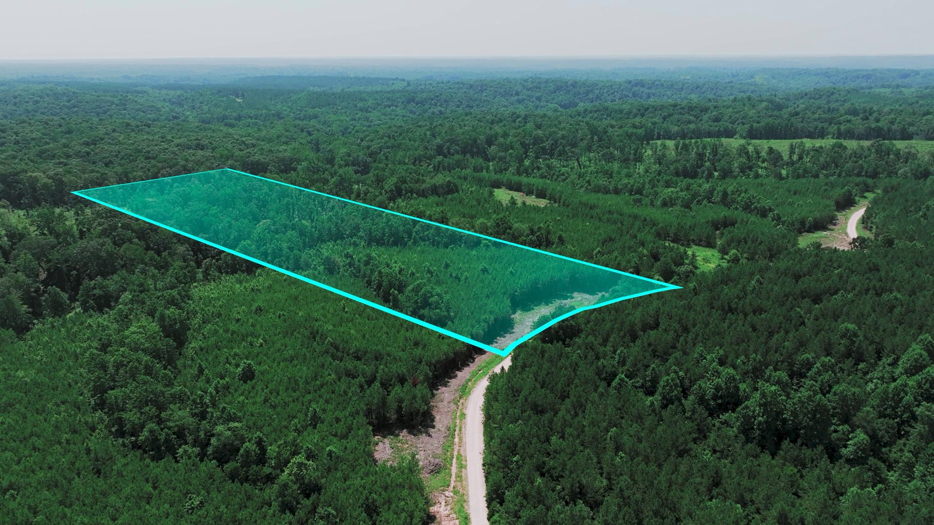
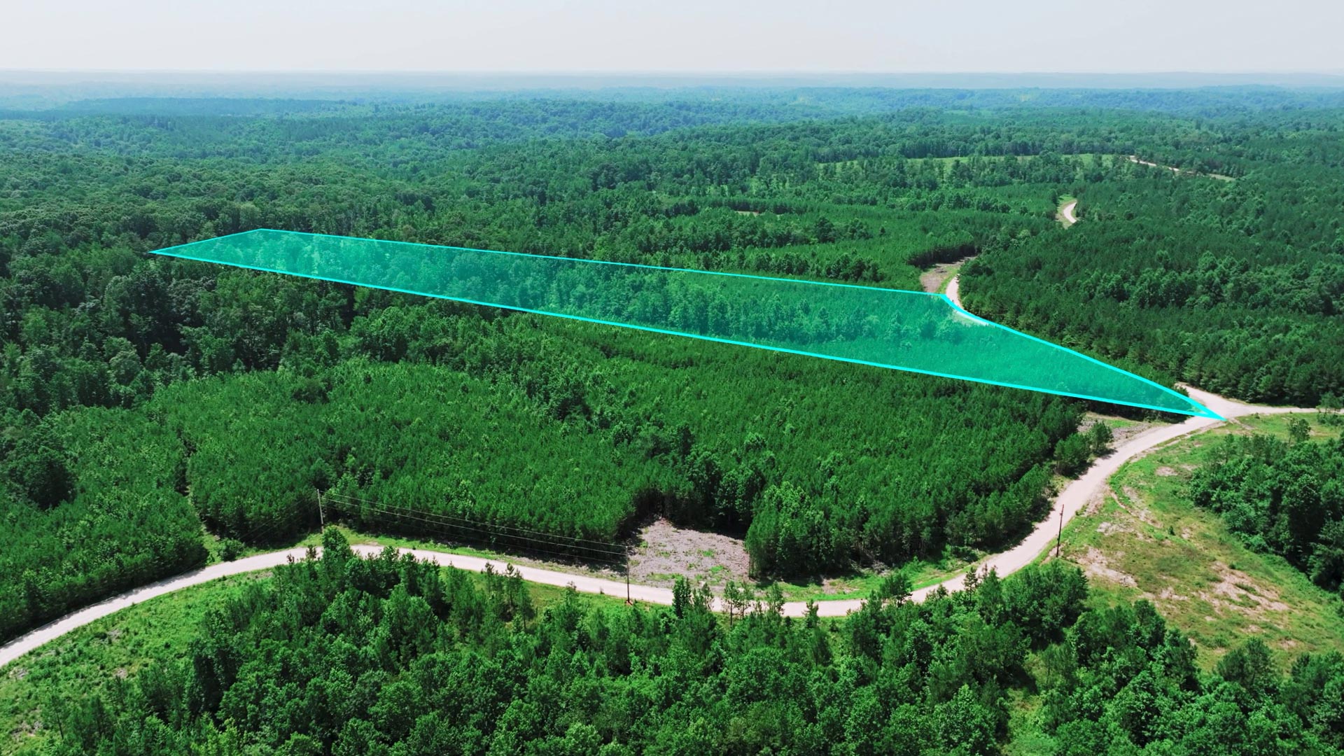
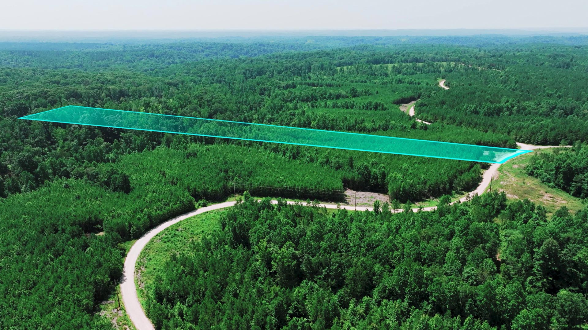
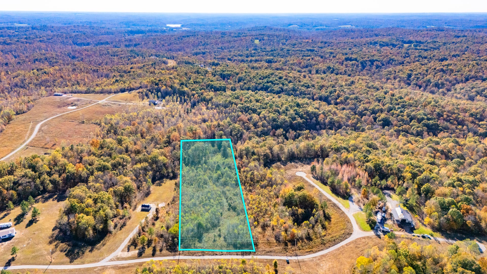
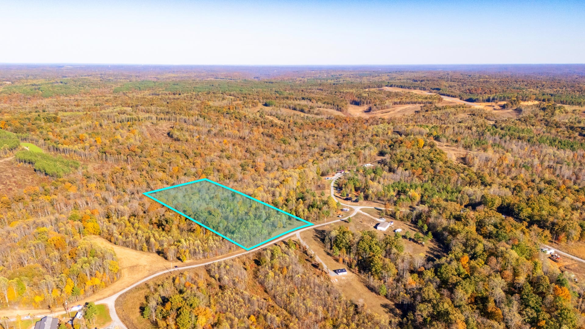
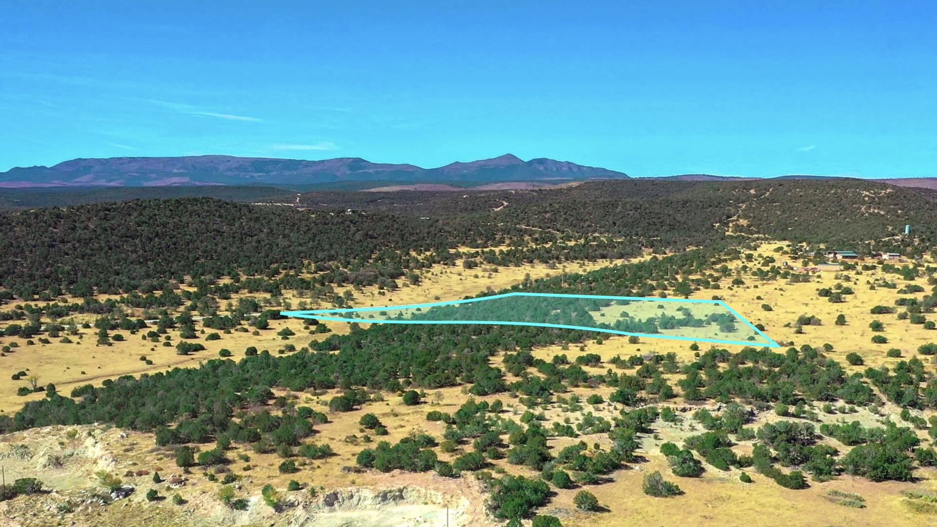
20 Wooded Mountain Acres bordering nearly 300,000 Acres of the Cibola National Forest less than 1 mile from "The Falls" waterfall.
This parcel borders the Cibola National Forest along the West boundary and is covered with dense mature Ponderosa Pines.
There is seasonal water flow running through the entire Eastern portion of the property.
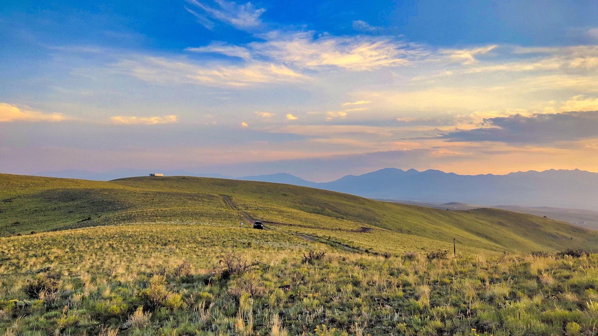
This beautiful forest property offers varying terrain, with the peak elevation on the Western portion near the Cibola National Forest reaching 7,640 feet. This is among one of the highest points in the area, comparable with the 7,700 foot Mesa located 4 miles South.
Bordering the Cibola National Forest comes with opportunity for extended recreation right from the property. The seasonal water flow also offers a source of water for the wildlife residing in the forest. See photos for the many wildlife tracks & droppings found on the property.
Located in Game Management Unit 10, which is said to be desirable for Mule Deer & Elk with some of largest Bulls in New Mexico. (Download the GMU 10 Map)
For more information, visit the New Mexico Game & Fish Department Website.
The richly diverse volcanic landscape of El Malpais National Park offers solitude, recreation, and discovery. Explore cinder cones, lava tube caves, sandstone bluffs, caves and hiking trails. Wildlife abounds in the open grasslands and forests.
The property is 8.7 miles to State Highway 53 which will take you directly to San Rafael to the East, then connects to I-40 to take you into Grants and Milan.
The city of Gallup is located 52 miles from the property. There is a Walmart Supercenter, various parks, professional services, medical centers, groceries, and supplies located here. The population of Gallup, New Mexico is about 21,700.
Grants, New Mexico is also located only 61 miles East, which has a population of around 10,000 people. In Grants you will find groceries, supplies, the Cibola General Hospital, an airport and Walmart Supercenter.
Utility Lines are in the area and on nearby developed properties where land owners have homes, mobile homes, cabins, accessory buildings and corrals (see photos & satellite images).
No HOA, HOA Fees, or time limit to build.
Property Specs
This Property is Presented by The Hemingway Land Company
For Questions or to Purchase this Property, please visit Hemingway Land
You may also contact Hemingway Land Customer Support anytime by Call or Text at: 702-919-7170
You may also reach Hemingway Land by email at: Support@HemingwayLand.com
Reference LANDIO Property ID: OR_Klamath_00002
Would You Like to See Your Property Featured on LANDIO? Visit: LANDIO.com/Feature
To Speak with LANDIO, Call or Text Us Anytime at 866-8-LANDIO (866-852-6346)
Property to Sell? Visit: SELLwithLANDIO.com
Nearby Points of Interest
Bordering the Cibola National Forest (more info)
0.27 mile to Ramah Falls (more info)
8.7 miles to Highway 53
19 miles to El Morro National Monument (more info)
33.1 miles to the El Malpais National Monument (more info)
33.6 miles to the Oso Ridge Lookout (more info)
35.4 miles to the Ice Cave and Bandera Volcano (more info)
52.5 miles to Gallup, New Mexico : Population 21,700 (more info)
56.7 miles to San Rafael, New Mexico : Population 1,000
58.6 miles to the Bluewater State Park (more info)
60 miles to Interstate 40
61 miles to Grants, New Mexico: Population 10,000 (more info)
61.5 miles to Milan, New Mexico : Population 3,200 (more info)
82.5 miles to the Mount Taylor (more info)
137 miles to Albuquerque, New Mexico : Population 556,000 (more info)
Location Information
To Visit This Property, Please Call the Listing Agent Paul Linson at: at: 505-907-1454
The Interactive Maps are generated with MapRight. MapRight has a Free Apple and Android App which can be useful when visiting a property. Below are links to download the Free MapRight App.
Apple (Download App)
Android (Download App)
Interactive Map (View Map)
GPS Coordinates
Northwest Corner: 35.2112301717262, -108.451841649108 (Google Map)
Northeast Corner: 35.2112121367072, -108.447455305649 (Google Map)
Southeast Corner: 35.2095039461638, -108.447431024468 (Google Map)
Southwest Corner: 35.2095218936116, -108.451796661172 (Google Map)
Center Point: 35.210329, -108.449735 (Google Map)
Contact Information
This Property is Listed with New Mexico Real Estate Broker Paul Linson of The Pedroncelli Group Realtors.
If you are interested in Purchasing this Property or any other Property in New Mexico, please contact Paul by Call or Text anytime at: 505-907-1454
Please Reference LANDIO Property ID: NM_Cibola_00066
To Speak with LANDIO, please Call or Text Us Anytime at 866-8-LANDIO (866-852-6346))
Do You Have Property to SELL? Visit at: SELLwithLANDIO.com
Buying Process
Sell Your Property
Questions About This Property?
Contact UsMore
Oregon
Properties
Texas
TX_Collin_00001
5.2 Acres with 3 Bedroom, 2 Bathroom Home & New Workshop near McKinney, Texas
Tennessee
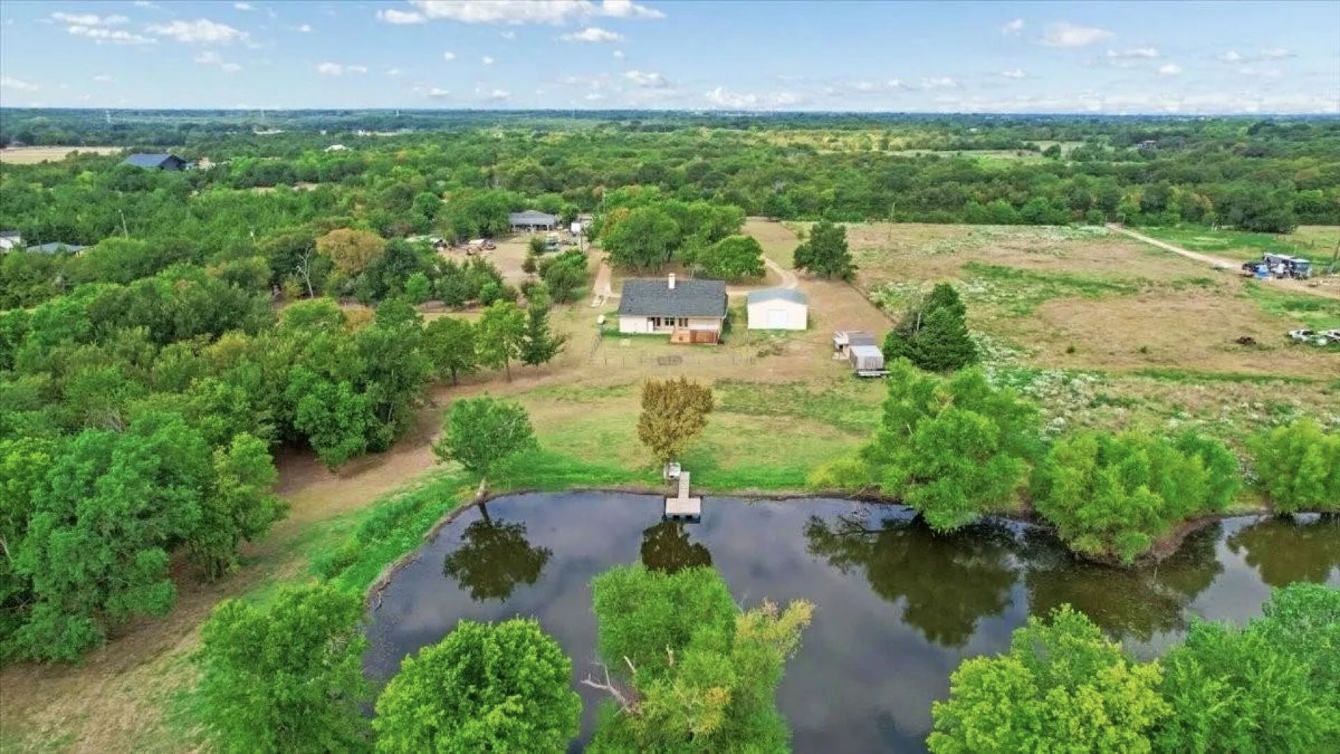
TN_Marshall_00001
13.77 Acres in Tennessee with Water, Sewer & Power
Texas
TX_Hunt_00001
53 Acres with 2 Homes & Workshop near McKinney, TX
Colorado
CO_Saguache_00009

40 Acres with Main Home, Accessory Buildings & Rocky Mountain Views
Wyoming
WY_Park_00002
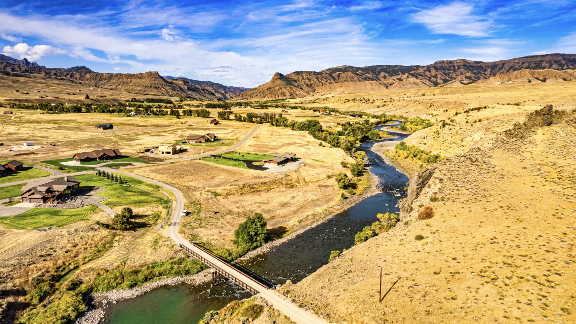
1.65 Acres with Water, Sewer, Power, Internet & Access to the Shoshone River
Tennessee
TN_Stewart_00120
8.3 Acres in Tennessee with Power, Fiber Internet, Road Access & Mature Trees
Tennessee
TN_Stewart_00119
6.5 Acres in Tennessee with Power, Fiber Internet, Road Access & Mature Trees
Tennessee
TN_Stewart_00118
14.4 Acres in Tennessee with Power, Fiber Internet, Road Access & Mature Trees
California
CA_Lake_00001
70 Acres with Off-Grid Cabin & Amazing Views bordering over 1 Million Acres of Public Land
Wyoming
WY_Carbon_00062
40 Acres Corner Lot near Pathfinder Reservoir
Colorado
CO_Conejos_00024
137 Acres along the Rio Grande River with 3 Bedroom Custom Home & Workshop
Colorado
CO_Saguache_00008
800 Acres with Road Frontage, Power, Irrigation System & Rocky Mountain Views
Wyoming
WY_Carbon_00061

40 Acres with Creek & Mountain Views bordering State Land near Pathfinder Reservoir
Arizona
AZ_Pima_00002
1.26 Acres with Road Access, Power, Mountain Views & Water Available near Tucson, AZ
California
CA_San-Luis-Obispo_00001

Lot with Utilities in Lodge Hill Subdivision & Bordering Fiscalini Ranch Preserve
Tennessee
TN_Stewart_00078
11.6 Acres in Tennessee with Power, Fiber Internet, Road Access & Mature Trees
Tennessee
TN_Stewart_00077
10.4 Acres in Tennessee with Power, Fiber Internet, Road Access & Mature Trees
Tennessee
TN_Stewart_00076
7.7 Acres in Tennessee with Power, Fiber Internet, Road Access & Mature Trees
New Mexico
NM_Torrance_00019

20.6 Acres with Road Frontage, Power & Internet near National Forest
Nevada
NV_Humboldt_00001

Sprawling Ranch Land with Commercial Potential Picturesque & Private
New Mexico
NM_Cibola_00079

5.29 Acre Corner Lot with Power near Cibola National Forest
New Mexico
NM_Cibola_00078

Large Unrestricted Lot with Power & Underground Utilities
Arizona
AZ_Pima_00001

Incredible Creekside Estate in Tanque Verde—A Sonoran Desert Treasure
Colorado
CO_Huerfano_00110
35 Acres with Creek, Power, Road Access & Mountain Views
Florida
FL_Calhoun_00001

20 Acre Corner Lot with Power & Paved Road Frontage 30 Minutes from White Sandy Beaches
Tennessee
TN_Stewart_00030
4.1 Wooded Acres with Water Well, Road Access, Power & High-Speed Fiber Internet
New Mexico
NM_Cibola_00077

91 Wooded Mountain Acres with 3 Off Grid Cabins bordering Cibola National Forest
Colorado
CO_Saguache_00005

144 Acre Turn-Key Farm with Water Rights, 4 Wells, Greenhouse, Warehouse & 5 Bedroom Home
Tennessee
TN_Stewart_00021
6.6 Wooded Acres with Road Access, Power & High-Speed Fiber Internet
Washington
WA_Clark_00004

20 Acre Farmland in Battle Ground, WA
Washington
WA_Clark_00003

40 Acre Ranch Land with 2 Bedroom Home
Texas
TX_Bailey_00001

10,648 Acre +/- Turn-Key Profitable Farm & Ranch with Trophy Game Hunting
Colorado
CO_Costilla_00026

5.12 Acres Ranchette Close to Highway 160 & Mountain Home Reservoir
Colorado
CO_Costilla_00025

5.76 Acres Corner Lot with Power Close to Mountain Home Reservoir
California
CA_Lassen_00001

20.1 Acres with Road Access & Bordering BLM Land
Tennessee
TN_Wilson_00001

20 Acre Nashville Suburb Forest Sanctuary, Building-Ready, 36 Bedroom Soil Capacity
Michigan
MI_Oakland_00001

3.8 Acres with Pond, Power & Road Frontage in Farmington Hills
Colorado
CO_Park_00003

35 Acres with Amazing Mountain Views & Road Frontage near Pike National Forest
California
CA_Los-Angeles_00001

Laurel Canyon Buildable Lot near Jim Morrison's "Love Street" Home
Colorado
CO_Custer_00002
35.5 Acres with Road Frontage, Driveway, Building Site & Panoramic Rocky Mountain Views
Texas
TX_Hardin_00001

13 Wooded Acres with Highway Road Frontage in the Path of Growth
Tennessee
TN_Lewis_00002

5 Acres with Road Frontage, Riding Trails, Power & Internet
New Mexico
NM_Colfax_00002

9.94 Acres in Upscale Forested Community with Private Lake Access
Colorado
CO_Costilla_00022

Mesa-Top Property with Stunning Views & Power Close By
Texas
TX_Tarrant_00002

4.3 Acres of Commercial Development Land in Fort Worth, TX
Alabama
AL_Madison_00001

6.8 Wooded Acres with Utilities & Road Frontage in Huntsville, AL
Colorado
CO_Costilla_00020

Cul de Sac Hillside Lot with Power Overlooking Sanchez Reservoir
Colorado
CO_Teller_00004

Forested Cul de Sac Lot Close to Power & Underground Utilities
Colorado
CO_Park_00002

Corner Lot with Power Forested Mountain Community
South Carolina
SC_Laurens_00001

33 Acres of Commercial Land with Interstate Frontage
New Mexico
NM_Cibola_00075

Partially Fenced Lot with Power, Underground Utilities & Highway Frontage
New Mexico
NM_Cibola_00040

20 Acres with Private Access to the Cibola National Forest
Tennessee
TN_Stewart_00019
3 Wooded Acres with Water Well, Road Access, Power & High-Speed Fiber Internet
Alabama
AL_Jefferson_00001
Corner Lot with Water, Sewer, Power & Internet near Birmingham, AL
California
CA_Inyo_00011

0.87 Acres with Mountain Views near Inyo National Forest
California
CA_Inyo_00010

0.83 Acres with Mountain Views near Inyo National Forest
California
CA_Inyo_00004

0.77 Acres with Mountain Views near Inyo National Forest & Bordering BLM Land
New Mexico
NM_Torrance_00013

10 Acres with Power, Internet & Access near National Forest
New Mexico
NM_Torrance_00014
10.1 Acres with Power, Internet & Access near National Forest
New Mexico
NM_Cibola_00019