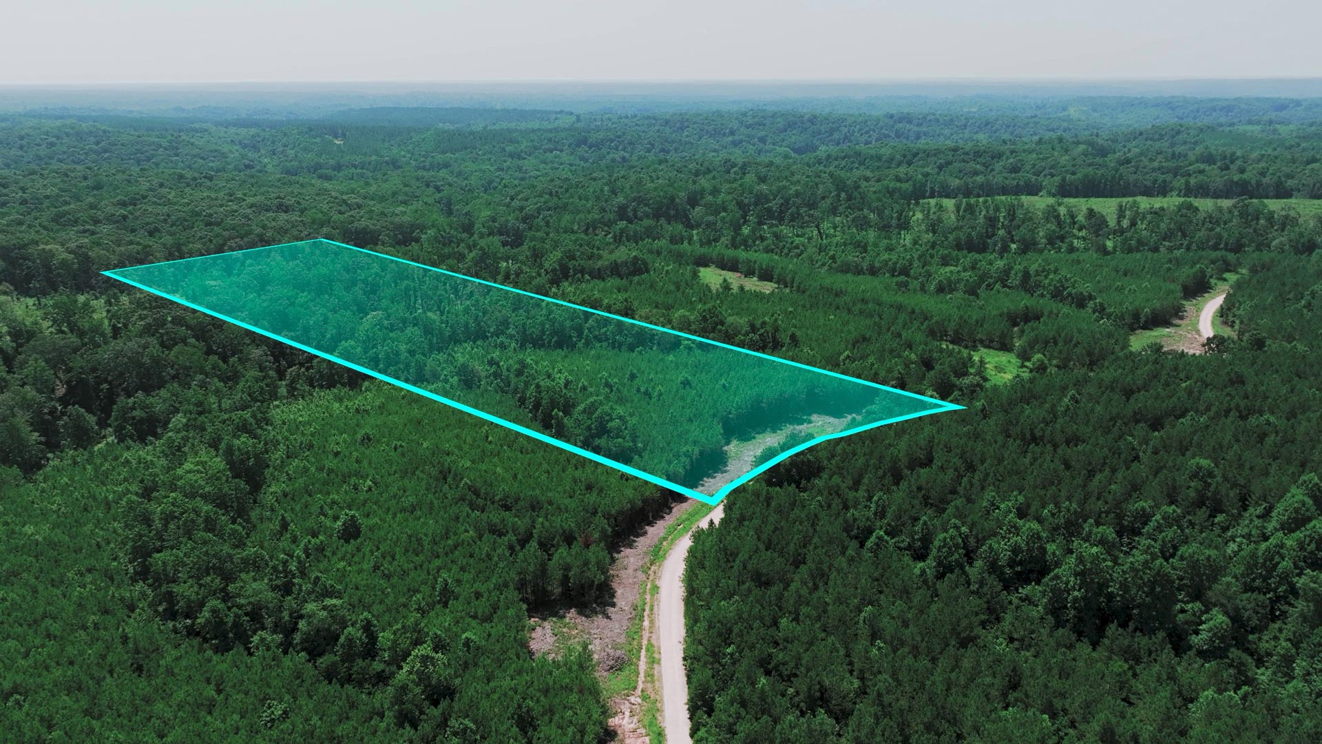
135 Acres in Montana on the Saint Regis River with Power & Road Access bordering the Lolo National Forest
Loading
Loading


LANDIO ID
MT_Mineral_00001
Montana
Mineral
135
Acre +/-
Acres +/-
Sold
Pending sale
$
$
1450000
1450000
USD
USD
Price
To Be Determined
Price
To Be Determined
The Sale of this Property is Currently PENDING.
Explore the AVAILABLE Properties
Price
To Be Determined
This Property is Listed with Montana Real Estate Broker, Theresa Lunn who is the Owner / Broker / Supervising Broker of UNITED COUNTRY REAL ESTATE-Western Montana Group, LLC.
For Questions, to Schedule a Tour or to Purchase this Property, Please Call or Text Theresa anytime at: 406-544-5970
You may also reach Theresa by email at: tlunn1960@gmail.com
Reference LANDIO Property ID: MT_Mineral_00001
Property to Sell? Visit: SELLwithLANDIO.com
To Speak with LANDIO, Call or Text Us Anytime at 866-8-LANDIO (866-852-6346)
Property Specs
Property Description
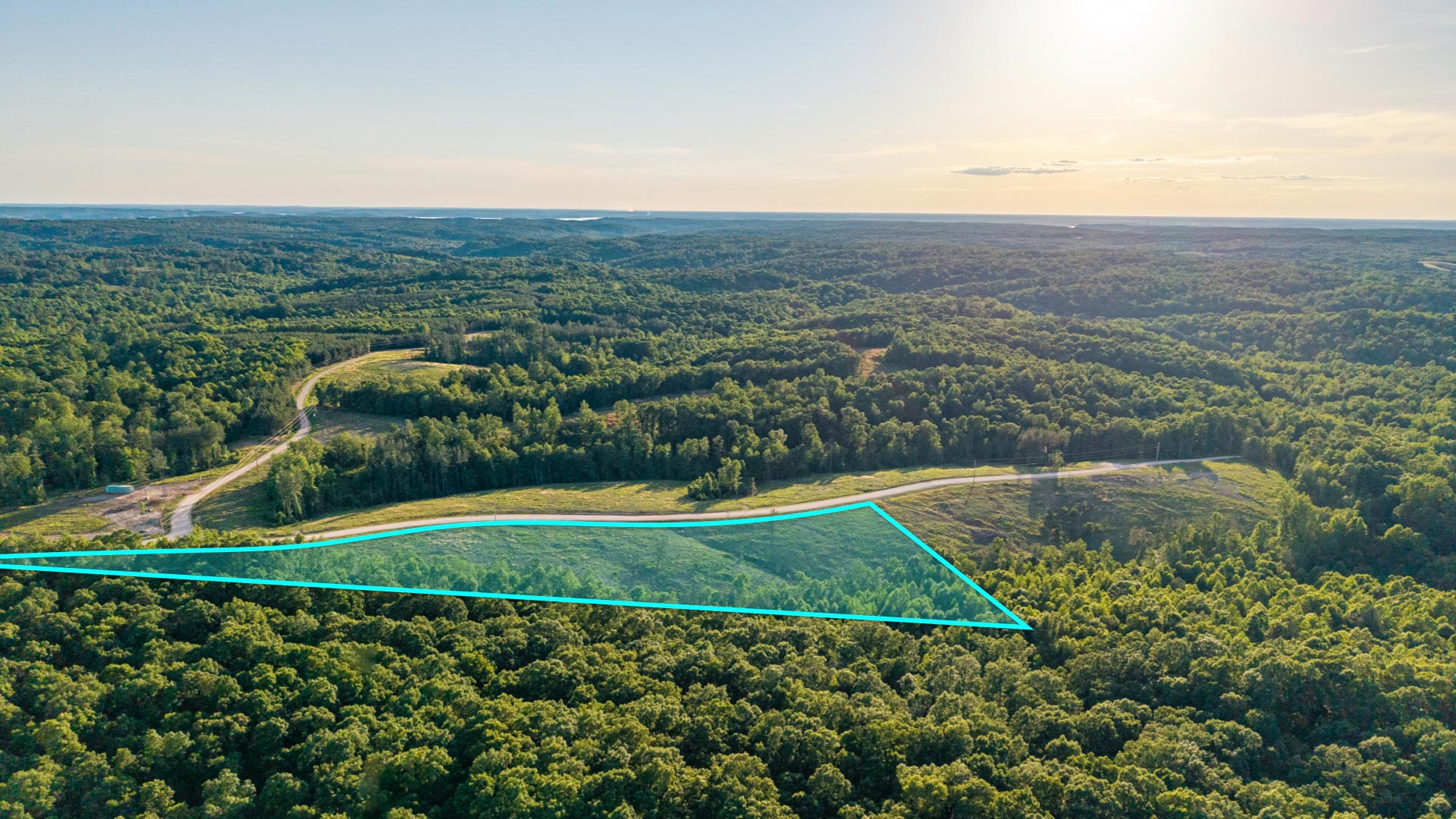
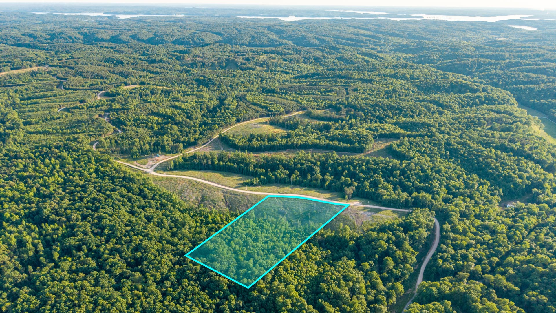
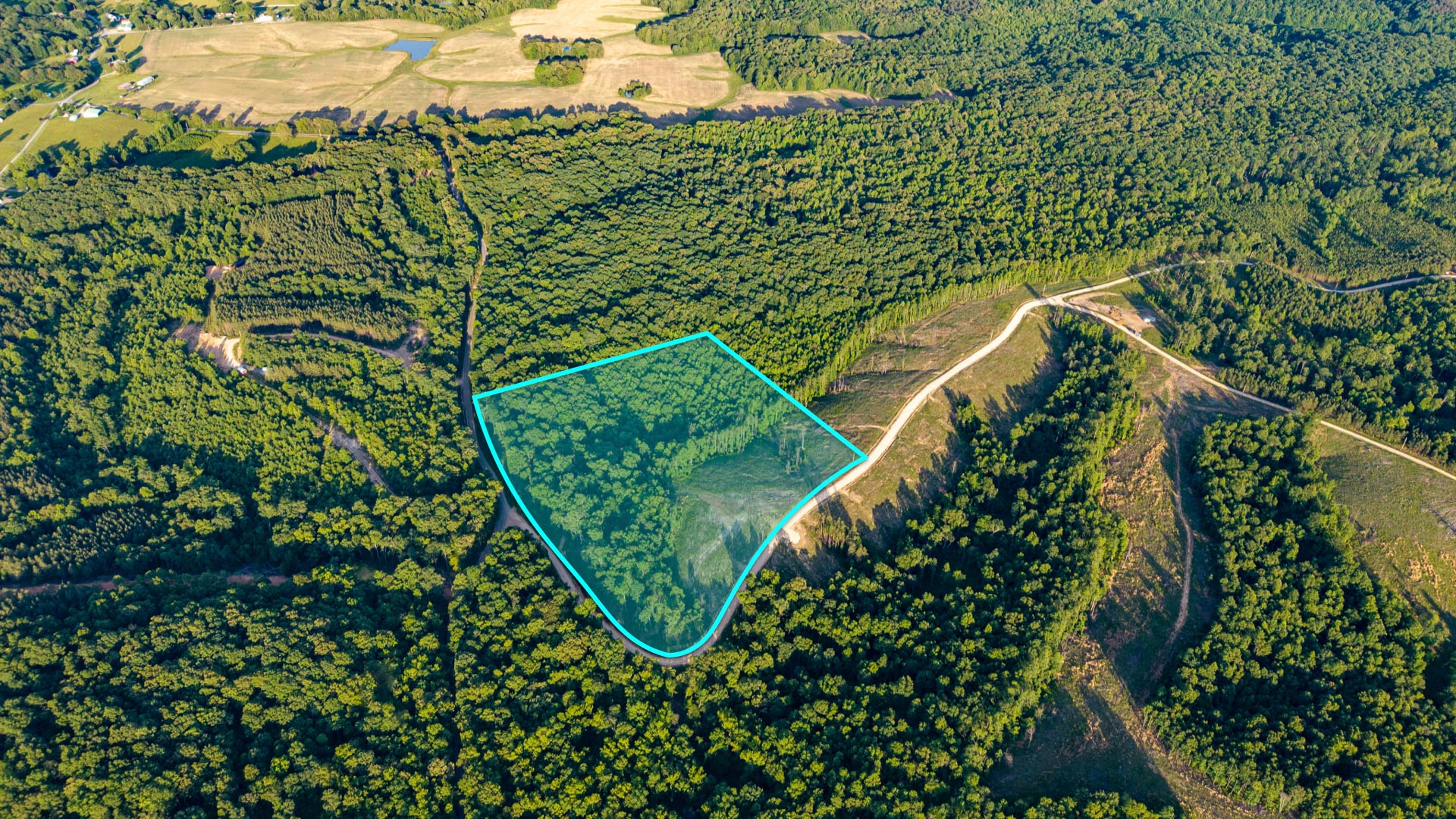
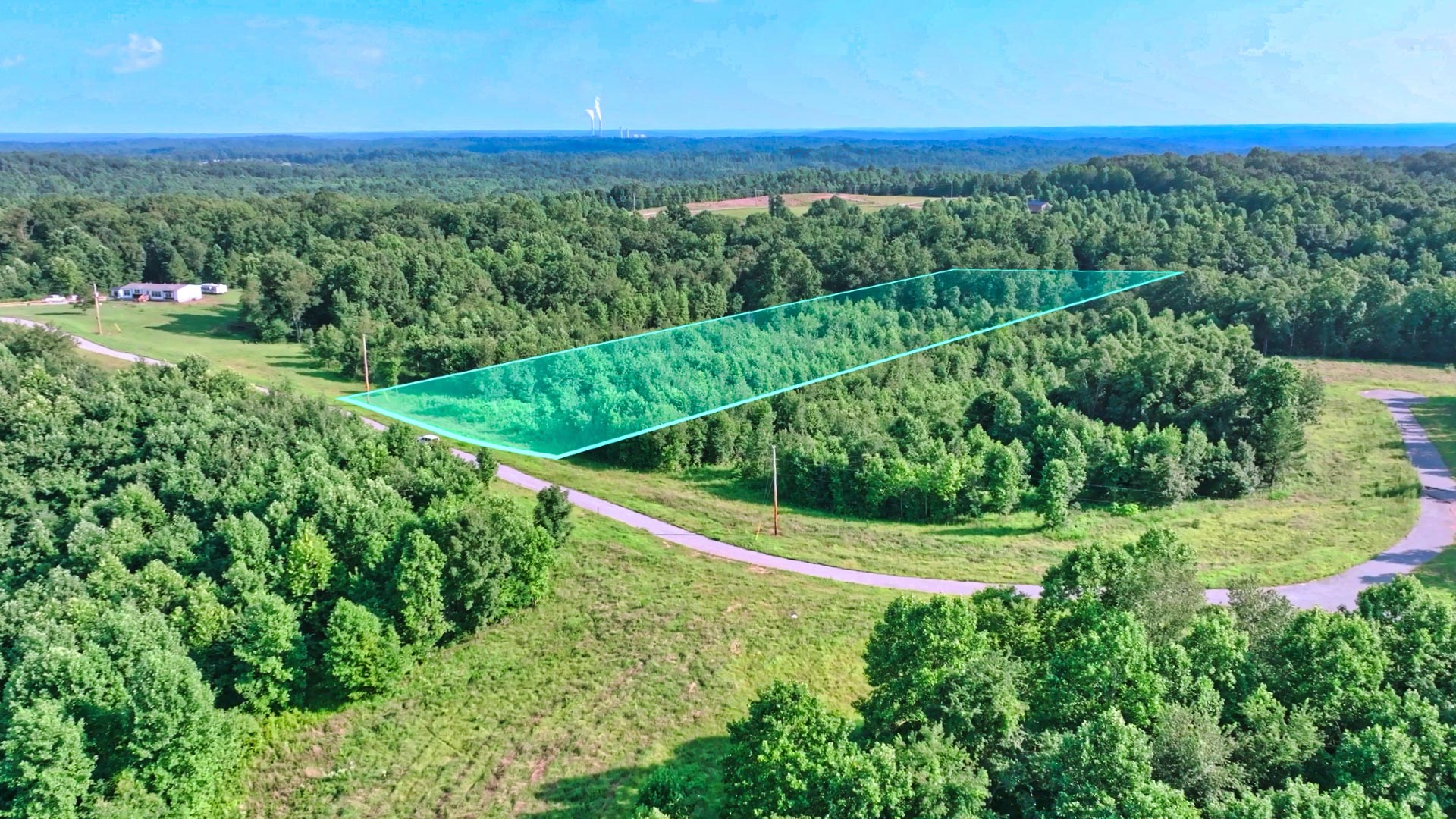
135 Acres on the St. Regis River & Bordering the Lolo National Forest
Tucked just above the Town of St. Regis in Mineral County, Montana, this 135 Acre Property stretches across Four Parcels that follow the curviture of the St. Regis River. It’s a landscape defined by contrast—where elevated Mountain Views among the Mature Pines ease down into lush Riverbanks and Wetlands below.
Few Properties blend the Peaceful Seclusion of Accessible Forested Ridges with the flow of a majestic River below quite like this one.
Each Parcel touches the Water, with the St. Regis River winding gracefully through all Four.
There are several potential Building Sites that offer perched views looking out over the valley or intimate, tucked-away spots near the River’s edge.
From higher elevations, you can see the St. Regis Valley unfold below, framed by the rugged slopes of the Lolo National Forest to the West.
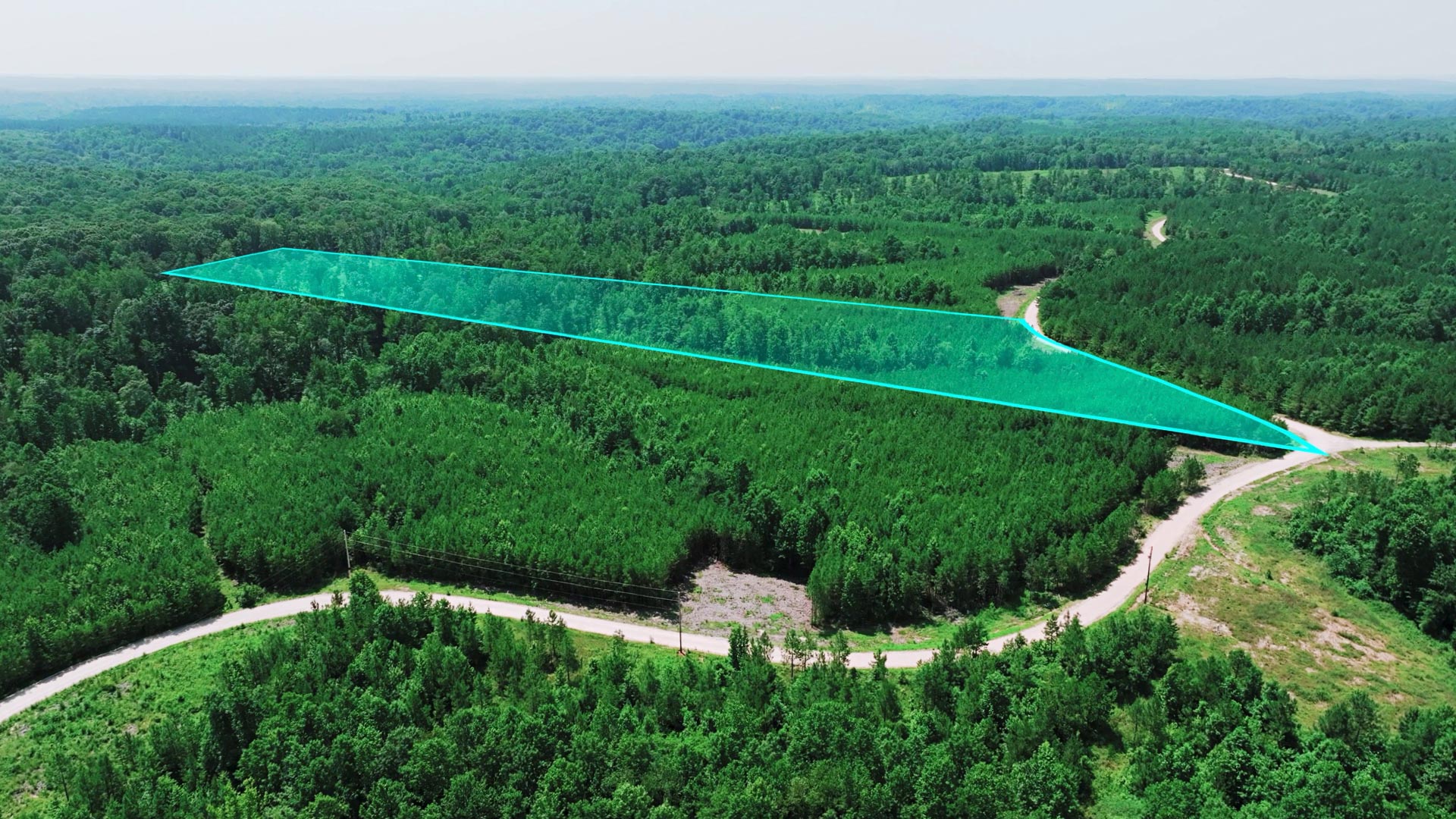
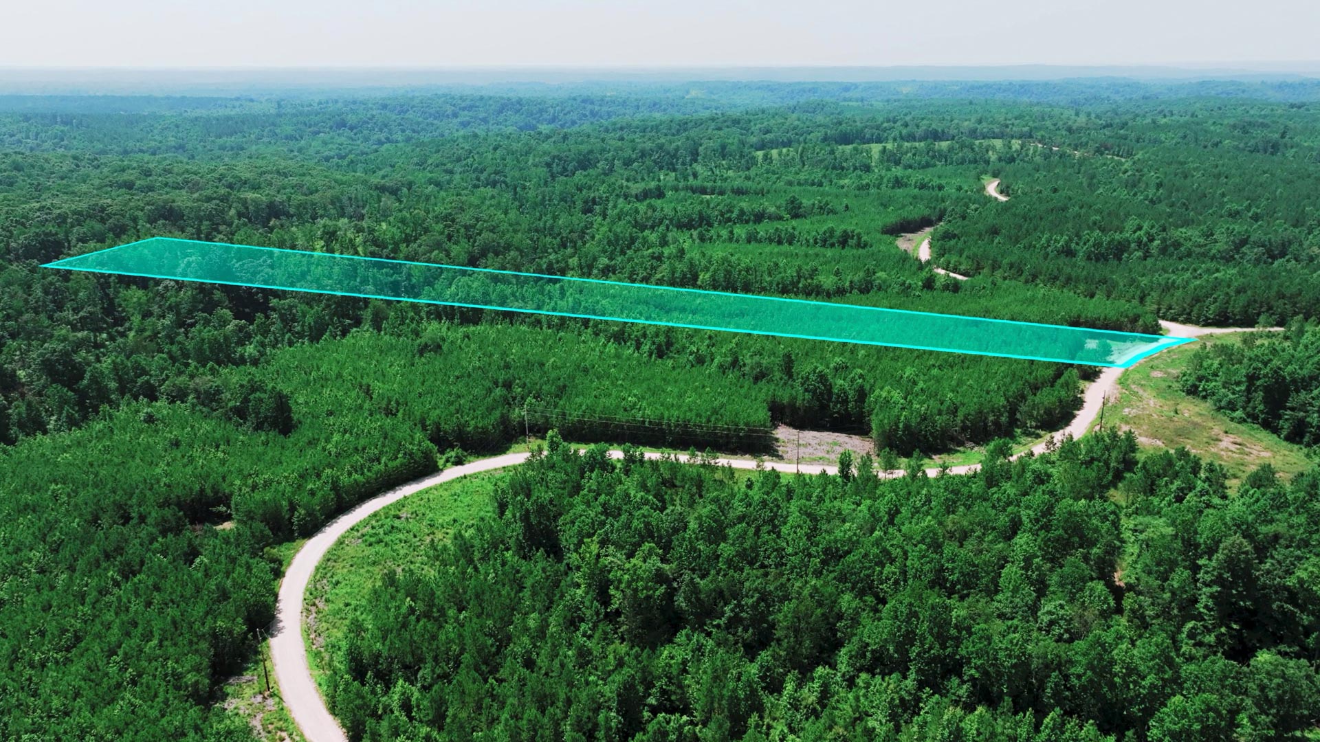
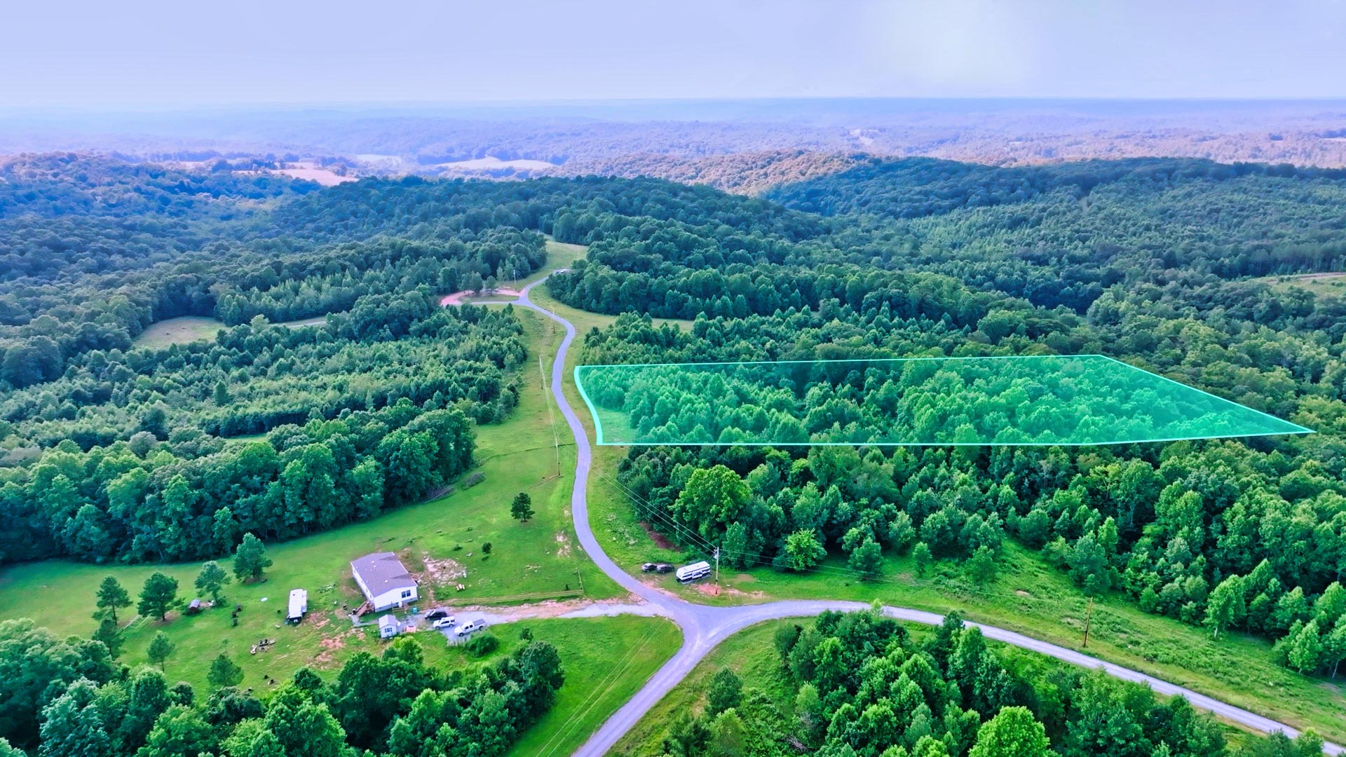
Access, Roads & Utilities
A Dirt Road weaves in and out of the Property along the Southern boundary, providing access to each of the parcels. There’s also a two-track road connecting from Cold Creek Road to the east that continues through the entire property, eventually leading directly into the Lolo National Forest. (Each parcel also has direct access to the forest along the southern border.)
For added convenience, I-90 Exit 33 is just north of the property, making it easy to reach Missoula, Coeur d’Alene, or Spokane.
Electricity is already available on the property, saving time and cost for future development. Multiple septic site evaluations have also been completed, offering flexibility and peace of mind for anyone planning to build. These established utilities and site assessments make the land well-prepared for a range of future uses—whether residential, recreational, or investment-oriented.
The Land and Setting
Over 3,400 feet of river frontage give you room to fish, explore, or listen to the rippling current. Wetlands and riparian corridors attract elk, deer, moose, and countless bird species, while timbered slopes add privacy and seasonal color. The property borders thousands of acres of public forest land, opening direct access to hiking, hunting, and backcountry exploration without ever needing to load up the truck.
Because it’s already divided into four legal parcels—each with existing road access and multiple suitable building sites—the land offers fantastic flexibility. Whether you’re imagining a private homestead, a family retreat, or maintaining natural areas while developing others, the groundwork is in place.
A Location Rooted in Montana’s Landscape
Just outside the quiet town of St. Regis, you’re close enough for daily needs but surrounded by breathtaking Montana wilderness. The area has long been known for trout fishing, big game, and its welcoming small-town spirit.
Below are a few nearby points of interest that define life in this part of western Montana:
• St. Regis, MT – A small community known for its friendly locals, fly fishing shops, and easy I-90 access.
• Lolo National Forest – Nearly two million acres of wilderness for hiking, hunting, camping, and winter recreation.
• Clark Fork River (Ferry Landing Picnic Area) – Just a short drive north, a great spot for kayaking, picnicking, or fishing where the Clark Fork and St. Regis Rivers meet.
• National Bison Range – About an hour east, this 18,000-acre wildlife refuge offers up-close views of bison, elk, and antelope in a stunning prairie setting.
• Missoula, MT – Roughly an hour away, Missoula provides a regional airport, dining, and cultural life while keeping your return to quiet country roads an easy drive.
• Flathead Lake – The largest natural freshwater lake west of the Mississippi, perfect for boating and summer weekends on pristine water.
• Coeur d’Alene, ID & Spokane, WA – Both cities are within a couple of hours west via I-90, offering additional travel connections and amenities.
• Glacier National Park – A scenic day’s drive north, with alpine trails, glacial lakes, and iconic views that define Montana’s wilderness heritage.
Envision Riverside Life Among the Pines of St. Regis
For buyers who know land and appreciate both its beauty and practicality, this property balances accessibility, privacy, and natural diversity.
With roads, power, and river frontage in place, the next chapter is open for your vision, whether that’s a hillside retreat among the pines, a few riverside cabins, or a property to pass down through generations.
Request More Info & Claim Your Parcel in St. Regis!
If this piece of Montana landscape is calling you home, reach out now for more information, or place a deposit to secure the rare stretch of river and ridgeline for yourself.
Property Specifications
LANDIO Property ID: MT_Mineral_00001
Price: $1,450,000
Parcel Size: 135 Acres +/-
General Elevation: 2,640 - 3,000 feet
Parcel Numbers: 54274325101040000, 54274325201010000, 54274325101050000, 54274325101010000
Property Taxes:
HOA: None
Approximate Distance to Nearby Points of Interest
Property Borders Lolo National Forest (more info)
0.5 miles to Saint Regis, MT : Population 345 (more info)
13 miles to Ferry Landing Picnic Area : Clark Fork River Access (more info)
51.6 miles to National Bison Range (more info)
71.3 miles to Missoula, MT : Population 78,000 (more info)
82.6 miles to Flathead Lake (more info)
93.9 miles to Coeur d'Alene, ID : Population 57,000 (more info)
112 miles to Kalispell, MT : Population 31,000 (more info)
127 miles to Spokane, WA : Population 231,000 (more info)
146 miles to Glacier National Park (more info)
Visiting the Property
To Schedule a Tour of this Property, Please Call or Text the Listing Broker, Theresa Lunn at: 406-544-5970
Interactive Map (View Map)
GPS Coordinates (approximate)
Northwest Corner: 47.297489359064, -115.118034588214 (Google Map)
Northeast Corner: 47.2979589929494, -115.104175039758 (Google Map)
Southeast Corner: 47.2915908784172, -115.093978991373 (Google Map)
Southwest Corner: 47.2957652960876, -115.117744239347 (Google Map)
Center Point: 47.296722, -115.104889 (Google Map)
Contact Information
This Property is Listed with Montana Real Estate Broker, Theresa Lunn who is the Owner / Broker / Supervising Broker of UNITED COUNTRY REAL ESTATE-Western Montana Group, LLC.
For Questions, to Schedule a Tour or to Purchase this Property, Please Call or Text Theresa anytime at: 406-544-5970
You may also reach Theresa by email at: tlunn1960@gmail.com
Reference LANDIO Property ID: MT_Mineral_00001
Property to Sell? Visit: SELLwithLANDIO.com
To Speak with LANDIO, Call or Text Us Anytime at 866-8-LANDIO (866-852-6346)
Property Description
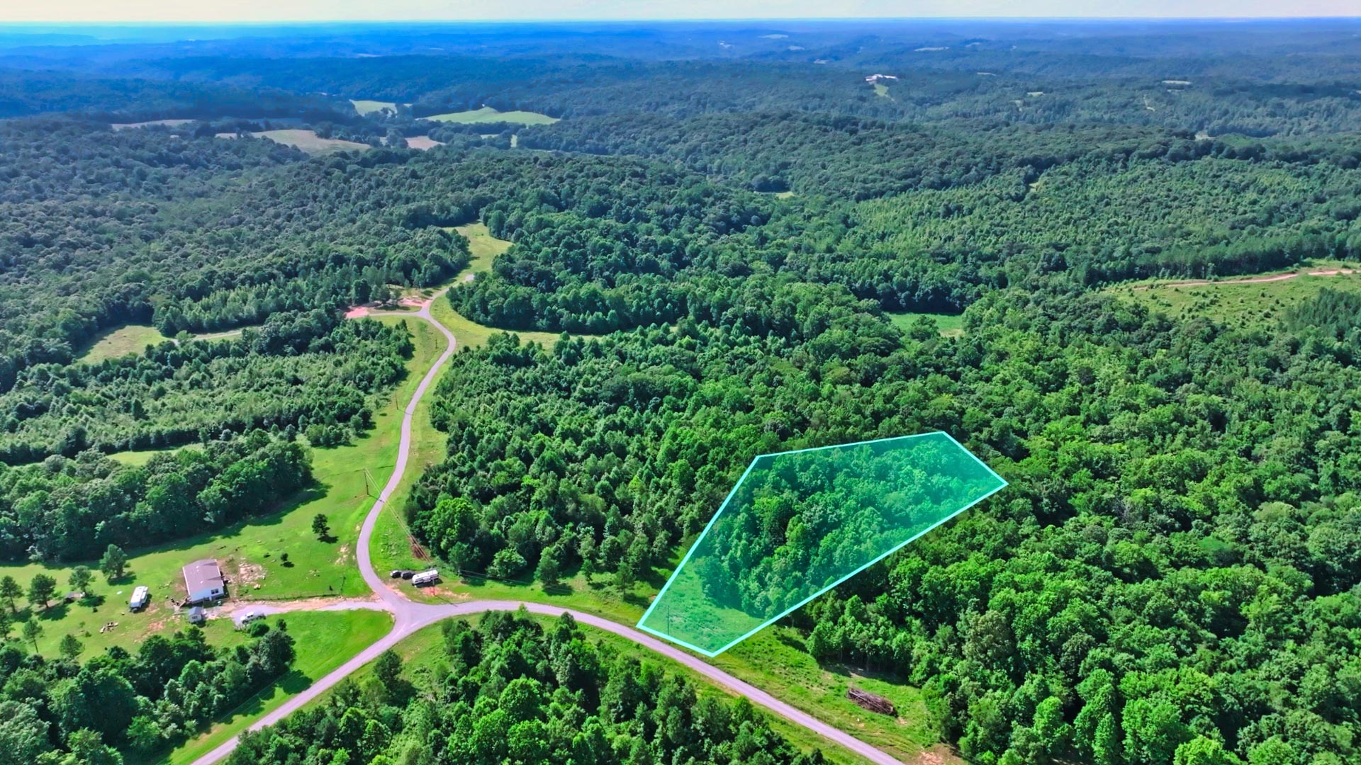
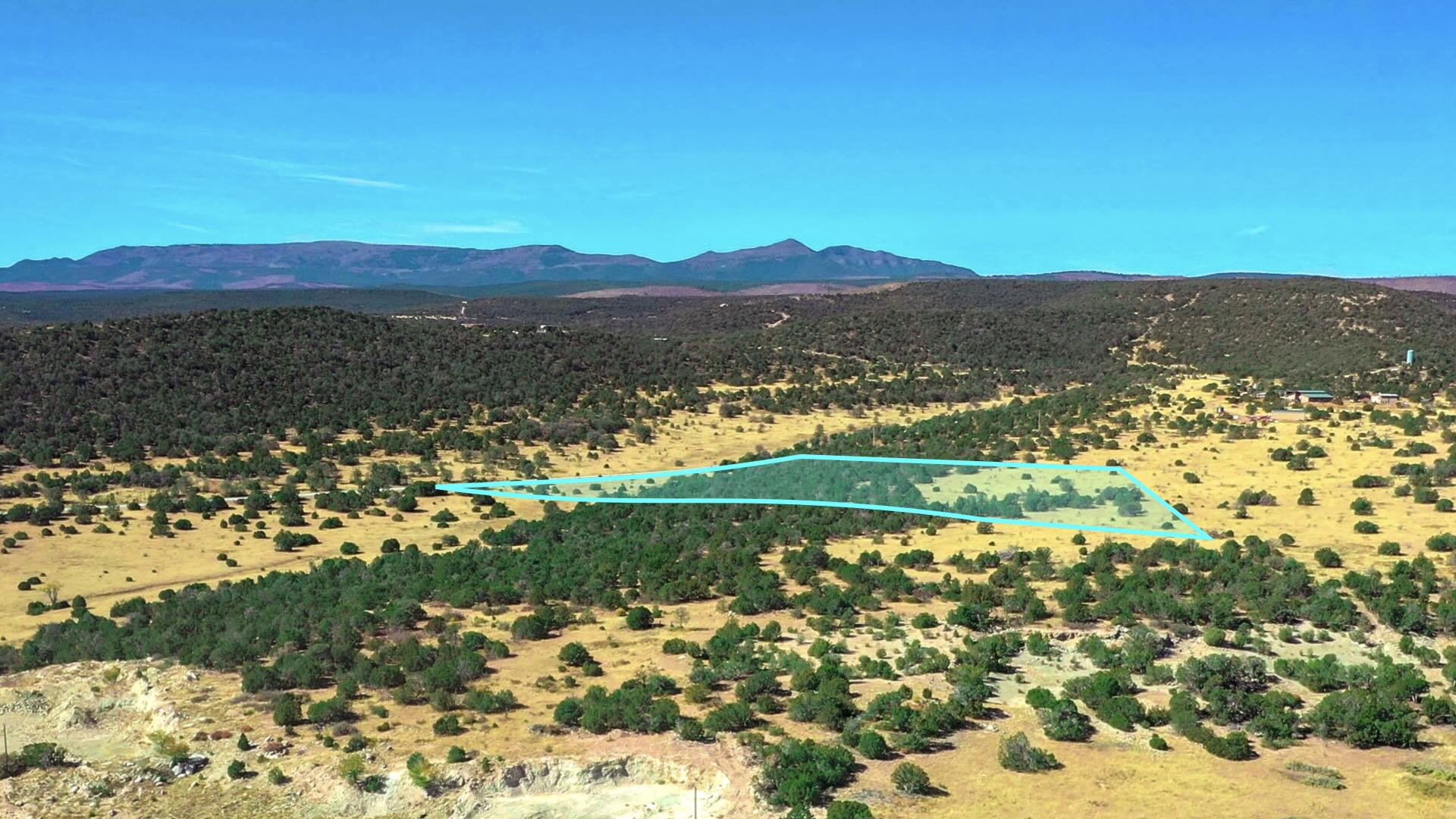
20 Wooded Mountain Acres bordering nearly 300,000 Acres of the Cibola National Forest less than 1 mile from "The Falls" waterfall.
This parcel borders the Cibola National Forest along the West boundary and is covered with dense mature Ponderosa Pines.
There is seasonal water flow running through the entire Eastern portion of the property.
This beautiful forest property offers varying terrain, with the peak elevation on the Western portion near the Cibola National Forest reaching 7,640 feet. This is among one of the highest points in the area, comparable with the 7,700 foot Mesa located 4 miles South.
Bordering the Cibola National Forest comes with opportunity for extended recreation right from the property. The seasonal water flow also offers a source of water for the wildlife residing in the forest. See photos for the many wildlife tracks & droppings found on the property.
Located in Game Management Unit 10, which is said to be desirable for Mule Deer & Elk with some of largest Bulls in New Mexico. (Download the GMU 10 Map)
For more information, visit the New Mexico Game & Fish Department Website.
The richly diverse volcanic landscape of El Malpais National Park offers solitude, recreation, and discovery. Explore cinder cones, lava tube caves, sandstone bluffs, caves and hiking trails. Wildlife abounds in the open grasslands and forests.
The property is 8.7 miles to State Highway 53 which will take you directly to San Rafael to the East, then connects to I-40 to take you into Grants and Milan.
The city of Gallup is located 52 miles from the property. There is a Walmart Supercenter, various parks, professional services, medical centers, groceries, and supplies located here. The population of Gallup, New Mexico is about 21,700.
Grants, New Mexico is also located only 61 miles East, which has a population of around 10,000 people. In Grants you will find groceries, supplies, the Cibola General Hospital, an airport and Walmart Supercenter.
Utility Lines are in the area and on nearby developed properties where land owners have homes, mobile homes, cabins, accessory buildings and corrals (see photos & satellite images).
No HOA, HOA Fees, or time limit to build.
Property Specs
This Property is Listed with Montana Real Estate Broker, Theresa Lunn who is the Owner / Broker / Supervising Broker of UNITED COUNTRY REAL ESTATE-Western Montana Group, LLC.
For Questions, to Schedule a Tour or to Purchase this Property, Please Call or Text Theresa anytime at: 406-544-5970
You may also reach Theresa by email at: tlunn1960@gmail.com
Reference LANDIO Property ID: MT_Mineral_00001
Property to Sell? Visit: SELLwithLANDIO.com
To Speak with LANDIO, Call or Text Us Anytime at 866-8-LANDIO (866-852-6346)
Nearby Points of Interest
Bordering the Cibola National Forest (more info)
0.27 mile to Ramah Falls (more info)
8.7 miles to Highway 53
19 miles to El Morro National Monument (more info)
33.1 miles to the El Malpais National Monument (more info)
33.6 miles to the Oso Ridge Lookout (more info)
35.4 miles to the Ice Cave and Bandera Volcano (more info)
52.5 miles to Gallup, New Mexico : Population 21,700 (more info)
56.7 miles to San Rafael, New Mexico : Population 1,000
58.6 miles to the Bluewater State Park (more info)
60 miles to Interstate 40
61 miles to Grants, New Mexico: Population 10,000 (more info)
61.5 miles to Milan, New Mexico : Population 3,200 (more info)
82.5 miles to the Mount Taylor (more info)
137 miles to Albuquerque, New Mexico : Population 556,000 (more info)
Location Information
To Visit This Property, Please Call the Listing Agent Paul Linson at: at: 505-907-1454
The Interactive Maps are generated with MapRight. MapRight has a Free Apple and Android App which can be useful when visiting a property. Below are links to download the Free MapRight App.
Apple (Download App)
Android (Download App)
Interactive Map (View Map)
GPS Coordinates
Northwest Corner: 35.2112301717262, -108.451841649108 (Google Map)
Northeast Corner: 35.2112121367072, -108.447455305649 (Google Map)
Southeast Corner: 35.2095039461638, -108.447431024468 (Google Map)
Southwest Corner: 35.2095218936116, -108.451796661172 (Google Map)
Center Point: 35.210329, -108.449735 (Google Map)
Contact Information
This Property is Listed with New Mexico Real Estate Broker Paul Linson of The Pedroncelli Group Realtors.
If you are interested in Purchasing this Property or any other Property in New Mexico, please contact Paul by Call or Text anytime at: 505-907-1454
Please Reference LANDIO Property ID: NM_Cibola_00066
To Speak with LANDIO, please Call or Text Us Anytime at 866-8-LANDIO (866-852-6346))
Do You Have Property to SELL? Visit at: SELLwithLANDIO.com
Buying Process
Sell Your Property
Questions About This Property?
Contact UsMore
Montana
Properties
Tennessee
TN_Marshall_00001
13.77 Acres in Tennessee with Water, Sewer & Power
Texas
TX_Hunt_00001
53 Acres with 2 Homes & Workshop near McKinney, TX
Colorado
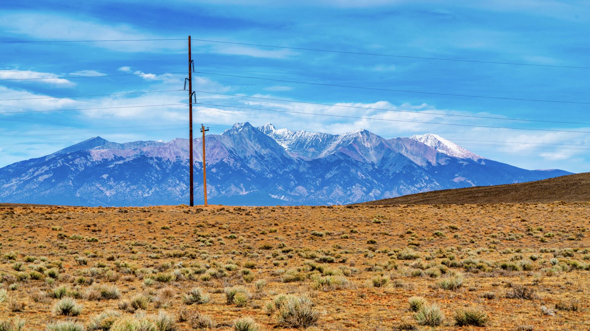
CO_Saguache_00009

40 Acres with Main Home, Accessory Buildings & Rocky Mountain Views
Wyoming
WY_Park_00002
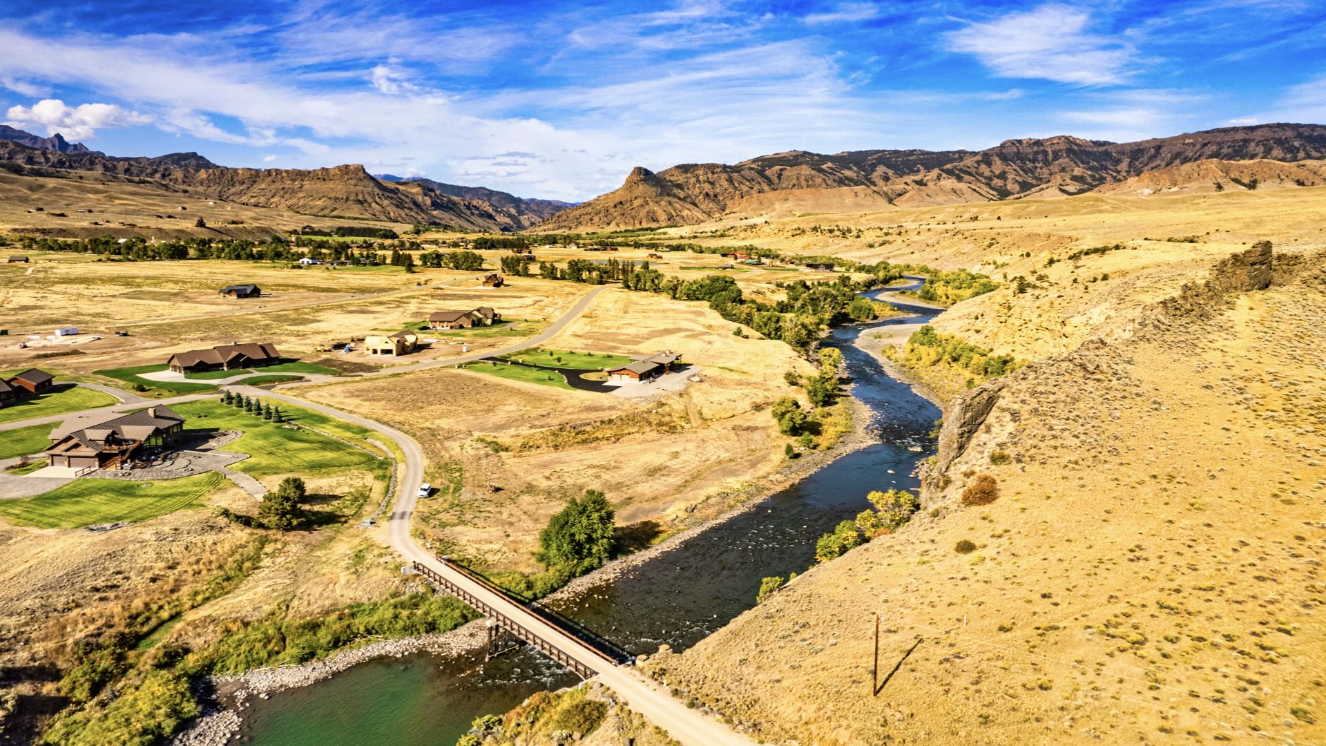
1.65 Acres with Water, Sewer, Power, Internet & Access to the Shoshone River
Tennessee
TN_Stewart_00120
8.3 Acres in Tennessee with Power, Fiber Internet, Road Access & Mature Trees
Tennessee
TN_Stewart_00119
6.5 Acres in Tennessee with Power, Fiber Internet, Road Access & Mature Trees
Tennessee
TN_Stewart_00118
14.4 Acres in Tennessee with Power, Fiber Internet, Road Access & Mature Trees
California
CA_Lake_00001
70 Acres with Off-Grid Cabin & Amazing Views bordering over 1 Million Acres of Public Land
Wyoming
WY_Carbon_00062
40 Acres Corner Lot near Pathfinder Reservoir
Colorado
CO_Conejos_00024
137 Acres along the Rio Grande River with 3 Bedroom Custom Home & Workshop
Colorado
CO_Saguache_00008
800 Acres with Road Frontage, Power, Irrigation System & Rocky Mountain Views
Wyoming
WY_Carbon_00061

40 Acres with Creek & Mountain Views bordering State Land near Pathfinder Reservoir
Arizona
AZ_Pima_00002
1.26 Acres with Road Access, Power, Mountain Views & Water Available near Tucson, AZ
California
CA_San-Luis-Obispo_00001

Lot with Utilities in Lodge Hill Subdivision & Bordering Fiscalini Ranch Preserve
Tennessee
TN_Stewart_00078
11.6 Acres in Tennessee with Power, Fiber Internet, Road Access & Mature Trees
Tennessee
TN_Stewart_00077
10.4 Acres in Tennessee with Power, Fiber Internet, Road Access & Mature Trees
Tennessee
TN_Stewart_00076
7.7 Acres in Tennessee with Power, Fiber Internet, Road Access & Mature Trees
New Mexico
NM_Torrance_00019

20.6 Acres with Road Frontage, Power & Internet near National Forest
Nevada
NV_Humboldt_00001

Sprawling Ranch Land with Commercial Potential Picturesque & Private
New Mexico
NM_Cibola_00079

5.29 Acre Corner Lot with Power near Cibola National Forest
New Mexico
NM_Cibola_00078

Large Unrestricted Lot with Power & Underground Utilities
Arizona
AZ_Pima_00001

Incredible Creekside Estate in Tanque Verde—A Sonoran Desert Treasure
New Mexico
NM_Luna_00031

19.8 Acres with Road Frontage, Fencing & Mountain Views
Colorado
CO_Huerfano_00110
35 Acres with Creek, Power, Road Access & Mountain Views
Florida
FL_Calhoun_00001

20 Acre Corner Lot with Power & Paved Road Frontage 30 Minutes from White Sandy Beaches
Tennessee
TN_Stewart_00030
4.1 Wooded Acres with Water Well, Road Access, Power & High-Speed Fiber Internet
New Mexico
NM_Cibola_00077

91 Wooded Mountain Acres with 3 Off Grid Cabins bordering Cibola National Forest
Colorado
CO_Saguache_00005

144 Acre Turn-Key Farm with Water Rights, 4 Wells, Greenhouse, Warehouse & 5 Bedroom Home
Florida
FL_Washington_00002

10.4 Wooded Acres with Spring Fed Pond, Power & Road Frontage near Panama City Beach
Tennessee
TN_Stewart_00021
6.6 Wooded Acres with Road Access, Power & High-Speed Fiber Internet
Washington
WA_Clark_00004

20 Acre Farmland in Battle Ground, WA
Washington
WA_Clark_00003

40 Acre Ranch Land with 2 Bedroom Home
Texas
TX_Bailey_00001

10,648 Acre +/- Turn-Key Profitable Farm & Ranch with Trophy Game Hunting
Colorado
CO_Costilla_00026

5.12 Acres Ranchette Close to Highway 160 & Mountain Home Reservoir
Colorado
CO_Costilla_00025

5.76 Acres Corner Lot with Power Close to Mountain Home Reservoir
California
CA_Lassen_00001

20.1 Acres with Road Access & Bordering BLM Land
Tennessee
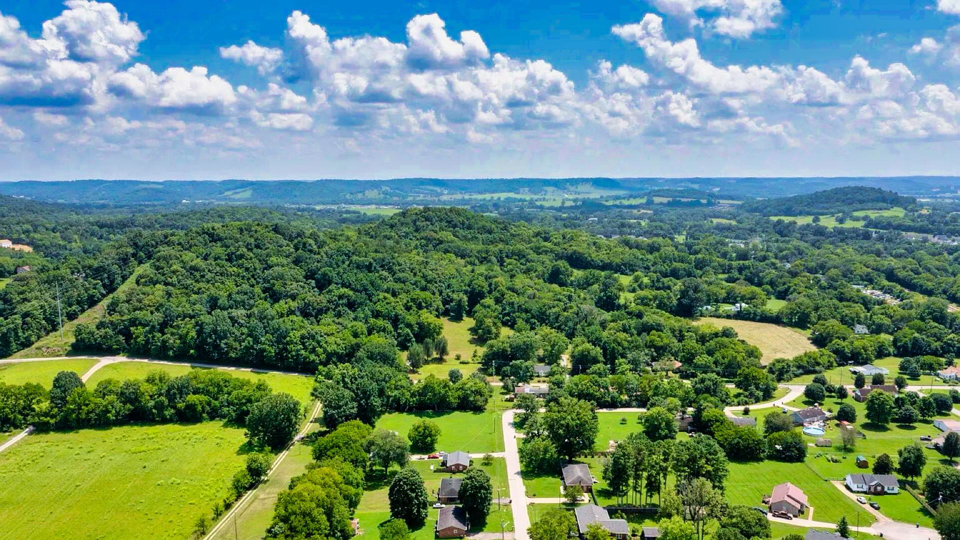
TN_Wilson_00001

20 Acre Nashville Suburb Forest Sanctuary, Building-Ready, 36 Bedroom Soil Capacity
Michigan
MI_Oakland_00001

3.8 Acres with Pond, Power & Road Frontage in Farmington Hills
Colorado
CO_Park_00003

35 Acres with Amazing Mountain Views & Road Frontage near Pike National Forest
California
CA_Los-Angeles_00001

Laurel Canyon Buildable Lot near Jim Morrison's "Love Street" Home
Colorado
CO_Custer_00002
35.5 Acres with Road Frontage, Driveway, Building Site & Panoramic Rocky Mountain Views
Texas
TX_Hardin_00001

13 Wooded Acres with Highway Road Frontage in the Path of Growth
Tennessee
TN_Lewis_00002

5 Acres with Road Frontage, Riding Trails, Power & Internet
New Mexico
NM_Colfax_00002

9.94 Acres in Upscale Forested Community with Private Lake Access
Colorado
CO_Costilla_00022

Mesa-Top Property with Stunning Views & Power Close By
Texas
TX_Tarrant_00002

4.3 Acres of Commercial Development Land in Fort Worth, TX
Alabama
AL_Madison_00001

6.8 Wooded Acres with Utilities & Road Frontage in Huntsville, AL
Colorado
CO_Costilla_00020

Cul de Sac Hillside Lot with Power Overlooking Sanchez Reservoir
Colorado
CO_Teller_00004

Forested Cul de Sac Lot Close to Power & Underground Utilities
Colorado
CO_Park_00002

Corner Lot with Power Forested Mountain Community
South Carolina
SC_Laurens_00001

33 Acres of Commercial Land with Interstate Frontage
New Mexico
NM_Cibola_00075

Partially Fenced Lot with Power, Underground Utilities & Highway Frontage
New Mexico
NM_Cibola_00040

20 Acres with Private Access to the Cibola National Forest
Tennessee
TN_Stewart_00019
3 Wooded Acres with Water Well, Road Access, Power & High-Speed Fiber Internet
Alabama
AL_Jefferson_00001
Corner Lot with Water, Sewer, Power & Internet near Birmingham, AL
California
CA_Inyo_00011

0.87 Acres with Mountain Views near Inyo National Forest
California
CA_Inyo_00010

0.83 Acres with Mountain Views near Inyo National Forest
California
CA_Inyo_00004

0.77 Acres with Mountain Views near Inyo National Forest & Bordering BLM Land
New Mexico
NM_Torrance_00013

10 Acres with Power, Internet & Access near National Forest
New Mexico
NM_Torrance_00014
10.1 Acres with Power, Internet & Access near National Forest
Texas
TX_Polk_00022

Wooded Lot with Utilities & Road Frontage near Lake Livingston
New Mexico
NM_Cibola_00019